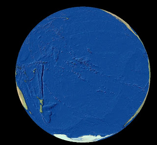
View of our Earth centered roughly on the South Pacific
I am haunted by a few nautical images that I have seen in movies; seascapes in
Master and Commander, and the old version
Moby Dick, (with Gregory Peck as Captain Ahab, chasing the great white whale around the globe) are two that rush to mind. Also there is a line from Disney’s Pirates of the Caribbean where Captn’ Jack Sparrow is waxing poetic about what a ship is.
“That's what a ship is, you know. It's not just a keel and a hull and a deck and sails, that's what a ship needs, but what a ship is... what the Black Pearl really is... is freedom.”
My reaction to these tells me that in another time, I may have been lured to a life on the sea (when the occupation of GIS/CAD professional was not so viable). To me there is something compelling about the geography of the globe that can be traveled by the Oceans and although it is a unpredictable and ominous path, it connects the whole world.
Here is a link to a recent interview for
GIS Weekly I gave regarding the newly released ArcGIS for AutoCAD:
“What Do CAD Users Want to Do With GIS?"


4 Comments:
Hi,
Do you know a way to export polygons, lines, points from a FGDB to Autocad, make some changes to the objects in Autocad, and reimport everything into FGDB without loosing all objects attributes ?
For example: I have a road in my FGDB. Some changes occur on the field and I need to update the road shape in my FGDB. To do this, I need (want) to use my favorite well working Autocad tools. Can I export to Autocad, make my changes and reimport to FGDB without loosing everything but the "shape" ?
Thanks
Xavier
It is a common request for which I hope there will be a better answer in the near future. Currently ArcSDE CAD Client and Autodesk Map's FDO provider only work with enterprise implementations of SDE. There was an application from Bentley (aquired from Haestad Methods) called GIS Connect for AutoCAD that did some of what you're looking for. I understand none of these are quite what you need. ArcGIS 9.3 might hold some better answers. If you need something today I might suggest the 5 part series I posted on the subject: http://giscadblog.blogspot.com/2006/08/whats-new-in-arcgis-92-for-cad-part-1.html
Thanks for your answer !
We can also work with SDE (only 9.1 for now).
I tried ArcSDE CAD Client one ore two years ago but if I remember well it used to transform curves ito hundreds of short straight lines which are hardly usable in ACAD.
Was there any change since that time (do curves now stay curves)?
If not, would Autodesk Map FDO do a cleaner job ? Does it work with SDE 9.1 ? I suppose I would have to buy AutoCAD Map 2008 instead of my AutoCAD 2004 !?
Thanks again for your help !
Autodesk Map's FDO provider for Simple Feature layers in ArcSDE, although based on old-style ArcSDE layers (not geodatabase feature classes) has a more modern implementation and is technically superior in function to the free and arguably aging ArcSDE CAD Client application.
Using ESRI Desktop tools like Export to CAD generate AutoCAD drawings much cleaner and with more flexibility than FDO or CAD Client especially geodatabases.
I wrote a series of articles a while back on the topic:
http://giscadblog.blogspot.com/2006/05/arcsde-cad-client-9.html
Post a Comment
<< Home