Semantic Translation Part 5: Layers or Layers?

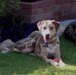
I'd like to introduce you to the newest member of my family, Sahara. She is a Catahoula Leopard Dog. She's one and a half years old and we adopted her from a dog rescue group. We anticipate that she will be a great addition to the family.
... How to spin this into a GIS and CAD interoperability example for semantic translation? ... I think the name of her breed is a good place to start. She is a "Leopard Dog" which is an oxymoron (cat/dog). It got me thinking about the similarities and differences between these two domestic carnivors and their behaviors.
Dogs and cats both have tails, but wagging them can mean something very different in one or the other. I once saw a comic strip where the care of the loving owner of both a dog and a cat invoked different responses from her pets.
The dog thinks: Hey, she feeds me, loves me, provides me with a nice warm, dry house, pets me, and takes good care of me . . .
She must be a god!
The cat thinks: Hey, she feeds me, loves me, provides me with a nice warm, dry house, pets me, and takes good care of me . . .
I must be a God!
Perhaps the conflicting jargon of GIS and CAD is worth mentioning here. The word layer within GIS can have both a general and very specific meaning. In GIS a layer is sometimes called a feature class to describe in general terms a GIS data set. Technically an ArcGIS feature layer is built from a feature class and may contain extra information about joined attributes, selection sets and symbology.
In CAD the same word layer describes a property of an entity in a drawing. Like color all entities have a layer property. Unlike the CAD color property a CAD layer property is special in that the CAD user-interface has special display behavior associated with the layer property. In CAD you can control the visibility and changeability of an entity based the CAD layer property. Technically this logical grouping and associated visibility and editing control could have been designed to use CAD color property or the linestyle property.
Unlike CAD's definition of a layer, the GIS layer has much more to do with how data is stored, identified and manipulated. The CAD layer property is transient and objects can change layers as easily as they change color. The flexibility of storing all different types of CAD entities on a single CAD layer has definite advantages in CAD. You can easily organize and manage the visibility of entities in CAD manipulating the CAD layer property.
Because GIS and CAD both use the jargon term, layer, to describe an important data organization concept there is bound to be some confusion. CAD drawings could be structured to mimic the rules of homogeneous feature type and data system consistency, but there is nothing in the CAD application that would limit the data to these arbitrary restrictions. Simply importing a CAD sewer layer will not guarantee that you will get the desired GIS sewer layer as a result, any more than importing all the green entities in a given CAD drawing might result in GIS sewer lines.
The direct-read CAD feature class of ArcGIS displays the CAD layer property as simply another attribute in the virtual feature attribute table along with the CAD color, layer, linestyle, etc... The CAD layer behaviour is perhaps most analogous to the Group Layer concept in ArcGIS.
Continue to Part 6...


0 Comments:
Post a Comment
<< Home