3D GIS and CAD: GIS-Generated 3D CAD Scenes
 A hot topic these days is the desire to work with all forms of data in 3D. ArcGIS supports many forms of 3D mapping data including CAD. The ArcGIS 3D viewers include ArcScene and ArcGlobe.
ArcGIS also supports the creation of 3D GIS features from 2D and 3D CAD data and the creation of 3D CAD features from 2D and 3D GIS data.
Here is a suggestion for a clever 3D use of the EXPORT TO CAD tool... Use your GIS to parametrically populate 3D scenes in AutoCAD.
ArcGIS supports the creation of AutoCAD blocks with the ArcGIS-ArcInfo EXPORT TO CAD tool from 2D or 3D ArcGIS points. Ponder for a moment the usefulness of creating 3D blocks, of houses or telephone poles or most anything in 3D. I've used this technique for over 12 years with the now discontinued ESRI ArcCAD product.
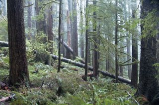
In 1993 I prepared 3D forest visualization drawings in ArcCAD using GIS tools to run a progressive aging model that included different growth rates, fallen trees based on different thinning schedules and other statistical parameters. The output of the results of the GIS analysis models were GIS points with attributes. These attributes were applied to a look-up table that generated different sizes and types of 3D blocks to represent a 3D view of a forest including fallen trees, cut trees etc...
This same technique could be applied to all different forms of visualization such as a office floor plan, hospitals, Airports, tract homes...
To create AutoCAD blocks from ArcGIS feature classes, you'll want to make sure there is a field in the output GIS points layer called 'CADType' that includes a value of "INSERT". You need to supply an AutoCAD seed file with the block definitions that you will want to reference. There also needs to be a field called 'RefName' that includes the name of the block you want to insert. You can even change of the scale of the block you want to place. You can completely change the visualization by changing the block you insert for a point or its size. By driving the 3D object creation from a smart database centric GIS toolbox you can create some interesting and useful results. I think its a pretty cool use of the tools. Try it, its fun.


0 Comments:
Post a Comment
<< Home