The Mysteries of AutoCAD Object Data: Part 3
Custom Objects
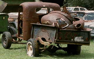 My talented neighbors have recently finished another amazing automotive restoration. This one is a 70’s era pickup truck. Before the restoration the pickup wasn’t much to look at, and it left me thinking, why invest any time or money on this hunk of junk. The artistic eye of this teenage boy saw something more… a dream machine in the rough! And, possibly his choice may have had something to do with the fact that he had to buy the car himself. I think the original plan was that the son would work at his restaurant job and save the money to buy the necessary parts and materials… That lasted about a week and then dad couldn’t help himself. Now with a better bank roll… off came the paint, upholstery, the doors, bumpers, the truck bed, some of the side panels, the engine, the wheels… Many of these items would never return. It got to the point that so many parts we’re completely replaced and meticulously reworked that it would seem to me that it would have been certainly easier, and even cost effective to just open up the catalog and order an entire truck from parts and have UPS ship it to the garage for assembly! At one point the son and his sister’s boyfriend were just hanging-out on the front step scrubbing a bucket full of rusty bolts all day long.
Autodesk Map 3D is a collection add-on customization code to extend the data structures of the basic CAD data model of AutoCAD to support the attribution of its geometric primitives for use in mapping. Autodesk 3D Civil is the same type of application to extend AutoCAD for Civil Engineering. Their primary method of attribute storage is object data. Autodesk Map/Civil 3D cannot function solely with standard CAD graphic entities. They introduces more sophisticated GIS data structures in the form of AutoCAD custom objects.
The definitions of the AutoCAD custom objects are stored in the AutoCAD data dictionary like object data, in some ways these custom objects are like a block definition that is stored in the AutoCAD symbol tables. However like the x-records used to store object data the custom objects and their complex geometries are not discernable without the controlling application that created them. To manipulate these custom objects AutoCAD must be re-educated on how draw and manipulate these foreign data structures. It is the responsibility of the controlling application to instruct AutoCAD what the various methods and properties are that will be supported by the custom object.
Neither AutoCAD nor LT can understand these objects. Read/Only versions of certain applications called object enablers can be obtained by AutoCAD users to understand these complex objects and sometimes their attribute data. The other method of making a custom object more readable to applications like AutoCAD and AutoCAD LT is for the custom application to create a proxy geometry definition along with the custom object. ArcGIS 9.2 now reads proxy geometries of AutoCAD custom objects as GIS features. A proxy geometry may be a pretty good representation of the original geometry, without its clever behaviors and attribution or it may be something less than that, all depending on the application that defines it.
posted by Don Kuehne at 12:41 PM
0 comments
![]()
![]()

 I just had a conversation with my mother in law regarding ideas for gifts for my 13 year old daughter. She called to get some suggestions from me. I asked her if she had seen the Christmas list my daughter had compiled that was posted on our refrigerator at home. Her comment was, "Yes … (then a pause)… I read it, but I didn’t know what any of the words meant. "

