March 28, 2007

Working with Text: Part 3

The ArcGIS Import CAD Annotation Tool

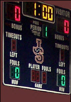
Spirit Academy’s Lady Warriors enter the California State tournament with an undefeated record of 17-0 in the regular season. A team invited from neighboring Arizona will be their first contest in a seeding game. The seeding game will determine how the teams stack up in the grid going into the tournament. The visiting Arizona team has no game history with the California teams in the tournament, and so there is no frame of reference for how they match up. After they play us the tournament committee will size them up and output the final brackets.

Just like the visiting Arizona team, there is no frame of reference for how CAD text should be displayed in the map-centric scale-dependent environment for which ArcGIS annotation was developed. CAD text traditionally has one size defined in drawing units. Annotation on the other hand has a scale dependent size defined usually in POINTS.

In order to size up the CAD text for display in ArcGIS as geodatabase annotation you need to supply reference scale and a size for that scale. The Import CAD annotation tools prompts for these two values. I have created a sample tool available on ESRI's ArcScripts.ESRI.com that helps you understand and calculate the appropriate values to enter into the Import CAD Annotation tool. You might also benefit from a more technical description found in the online help.
Go Warriors!

March 14, 2007

Working with Text: Part 2

ArcGIS Labels and Annotation

I really enjoy the way a small sailboat has gives me a feeling of being directly connected to the water, the air and the craft itself. More than just floating or paddling through the water, a sailboat allows me to use natural forces against one another for my gain. I can float if I want to, but generally I want to be going places.

In ArcGIS text can just float on its own, or it can be driven by features. In the most general terms GIS annotation could include any map text, marginalia, and displayed attributes. More explicitly there are different forms of text in ArcGIS using different data constructs. Any ArcGIS feature can have feature labels that are generated from attributes. Unlike ArcGIS feature labels ArcGIS annotation features are features in their own right. One higher level of annotation is that geometric features can have annotation features that belong to them, this is called feature-linked annotation. Or, text can be displayed as simple graphic text, that is not a feature, and not linked to other features, this form is the most similar to CAD text.

In ArcMap any GIS feature can have a displayed feature label. This feature labels can be toggled on an off as a property of the ArcMap label. The label can have justification and font properties and its text value is derived from the attributes of the feature layer. Labels are regenerated from the feature's attributes and generally are placed by a labeling engine. The default labeling engine has some simple options to avoid overlapping labels and the alike. An example of a high-end professional labeling engine would be something like ArcGIS’s Maplex labeling extension that uses sophisticated rules-based label placement algorithms. ArcGIS feature labels can be converted into ArcGIS annotation feature classes.

Another form of text, ArcGIS geodatabase annotation feature classes, have their own geometry, attributes and set of justification methods. Unlike feature labels that are placed on-the-fly using an engine from other feature layers’ attributes. Annotation features are persisted and stored in a feature class, along with their position and other display properties. Annotation features can be independent or they can be linked to other feature layers. Feature-inked Annotation derives its text value from the attributes of the linked feature class (like the diameter of a pipe, or name of a street), but retains its own separate geometry and properties (for example: a specific rotation or position on a map.)

You can learn more about ArcGIS text from the ArcGIS online help.

Tip:
ArcGIS feature labels cannot be exported using for example the Export to CAD tool, but the tool does export geodatabase annotation features, which I can generate from feature labels in ArcMap.


The ArcGIS CAD feature class that is generated in memory when a CAD file is used by ArcGIS, is yet another form of text. The CAD annotation feature class is implemented as a file-based
annotation. This type of annotation is more akin to the legacy ArcInfo Coverage Annotation feature classes. Suffice to say it is old-school and lacks many of the nifty functionality available with the invent of geodatabase annotation feature classes.

There is a tool to convert file-based annotation and CAD annotation feature classes to geodatabase style annotation. This tool is called the Import CAD Annotation tool…

March 05, 2007

ArcGIS for AutoCAD

I’ve been anxiously awaiting this debut, we’ve done a lot of work and we are well prepared. The Head Coach has a schedule conflict and has given me (the assistant coach) the nod to take the head coaching roll of our undefeated high school girl’s freshman basketball team for their next game. It is one thing to make suggestions as an assistant coach, it’s quite another to make the decisions at game time and be responsible for them. I am excited to get the opportunity, and give it a try.

Here is something else new to try… as seen at the ESRI Federal User Group Conference in Washington DC this past December, the ArcGIS for AutoCAD application from ESRI is now available for download just incase you missed the ArcNews Article.

ArcGIS for AutoCAD is a no-cost ESRI application that loads on top of AutoCAD 2007 and gives me the ability to add one or more ESRI Map Service view(s) to my AutoCAD drafting environment. The coordinates of the ArcGIS Map Service and the AutoCAD view are fused together. With this new ESRI technology I have direct access to every GIS data format without conversion and without translation inside AutoCAD through ArcGIS Server. I as an AutoCAD user see what the GIS professional sees; finished high quality cartographic representations of complex GIS data structures, stored in a wide variety of different, raster, grid, image and vector formats. I see the results of high-end cartography and sophisticated spatial analysis as represented by the finished map, served with ArcGIS server. Arguably I get the most benefit… the results, without ever having to concern myself with what data types I am working with, where the data is stored or how I should display the map content. I can work directly with ArcGIS Map Services to add full GIS context to my AutoCAD session.

ArcGIS for AutoCAD introduces a new form of CAD Interoperability, by passing GIS right through CAD rather than relying on special data connections, translation or conversion. I need not concern myself with what GIS data types I can or cannot read in AutoCAD. I need not worry about setting up ways to recreate the symbology of GIS Maps. I see the GIS map as created by the GIS professional. I have direct access to the attribute records stored in the spatial databases where ever they may be stored. The GIS functionality is simply passed back and forth between the GIS server from requests I make in CAD. You can download the software from ESRI here. It requires access to ArcGIS Server 9.2 map services and AutoCAD 2007.

March 02, 2007

Working with Text: Part 1

CAD Text

You may have heard it said that a boat is a hole in the ocean that you pour all your money into. I am of a small minority of people that can be pitied even by the average boat owner. I have a hobby of boat designing/building. At least with the normal boat owner, the boat does, or did at one time function as a boat, and with a little effort and maintenance will continue to function as such. However, I on-the-other-hand pour my money, and efforts into a boat that I spend 6 months constructing, sail for 40 minutes and then hack into pieces and rebuild for another 6 months. Sad if I think about it… I will think of something happier... like ArcGIS annotation! On second thought the hole in the ocean may be less dreary; too late I’m committed now.

Arguably one of the more confusing aspects of CAD interoperability in ArcGIS is the way text is handled. I get lots of questions related to the different ways text can be created, displayed, oriented and converted between CAD and GIS. This is compounded by the fact that CAD text is quite different than the various forms of ArcGIS annotation.

I guess its worthwhile defining some terms/concepts used by these two different technologies before I tackle some of the confusions caused primarily by these differences. Looks like another BLOG series…

CAD text is stored as an entity that has an insertion point, a text string and a number of text properties. These text properties are slightly different between AutoCAD and Microstation, but in contrast to GIS they are not really worth mentioning. One of the distinguishing properties of CAD TEXT is a text height. TEXT in CAD has a size in drawing units (unlike ArcGIS annotation). When you zoom in or out it is like any other object you see more or less of the same objects; closer or farther away; bigger or smaller. CAD text is an autonomous object that lives on its own… it is a TEXT object.

Another type of object printed on a CAD drawing could be AutoCAD block attribute or a Microstation tag. These objects unlike CAD Text entities are normally associated with something else. In the case of the AutoCAD block attributes they belong to an instance of an AutoCAD block, as a sub-entity of the block insert. To confuse the issue AutoCAD blocks instances (inserts) can contain actual text objects as sub-entities too. However, the block attribute is like a variable whose text string you can modify. The block attribute has a logical name. Because of this ArcGIS treats the block attribute like a feature attribute in ArcGIS CAD feature classes (But, that’s another topic.). In ArcGIS 9.2 block attributes are also considered an ArcGIS CAD Annotation feature and have their own insertion point and text properties, just like CAD text.

Microstation has a similar, but more powerful object called an element tag. A tag is an object that similar to a piece of text has size, font and justification properties. Similar to the AutoCAD block attributes it can be associated with another gemetric object. It also has a logical name and its text string can be modified as a variable or attribute in CAD. Different than the AutoCAD block attribute Microstation tags can belong to any other Microstation element geometry, including polygons and linear features (AutoCAD block attributes are really only associated with what could be interpreted as point features). In ArcGIS 9.2 Microstation tag elements are represented both as attributes of the CAD features they are associated with and as independent ArcGIS CAD annotation features.

Next, I’ll discuss a little more about the ArcGIS flipside…
FREE hit counter and Internet traffic statistics from freestats.com