CAD Standards from GIS with Seed Files
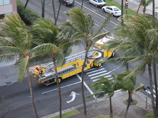
 As the assistant coach for my daughter’s high school basketball team I have the ability to influence, but not always to decide. I can make suggestions to strategy and present ideas, but ultimately the decisions belong to our head coach. He and I have our areas of expertise and because we have a good working relationship we submit to one another in those areas. One way to describe my role on our team is as the rear driver on the ladder truck. The head coach is driving the truck with everyone on-board to our destination. I am at the back steering to keep us on the road.
When working in organizations where there are distinct GIS and CAD related activities there is often one group that takes the lead and another one that supports the overall objectives of an organization. Certainly when the goal is to WIN the team functions better when the coaches aren’t taking things in different directions.
Coordinated efforts to move data back and forth can come from mandatory decrees that come from on high, working together (preferred) , or as a result of good unilateral planning as in the case of one strategy implemented by Truckee-Donner as a unilateral program where the CAD group is not under one authority, but rather is attempting to support any number of contractors not directly under their control.
One practical way for me as a CAD manager to get better CAD files from my GIS group is to sit down with my GIS manager and provide him with a CAD seed file that already contains my coordinate system and CAD layer and symbology standards as a template. This by itself can greatly enhance the readability and use of CAD data generated by the ArcGIS EXPORT TO CAD tool, or the ArcGIS Data Interoperability Extension. Both ESRI software tools that create CAD files from GIS content have the ability to explicitly define to exacting standard entity level symbology with a multitude of configurable CAD property designations. However, with my layer-based symbology standards I can supply my seed file in anticipation of CAD entities placed on those layers to greatly simplify the process. The GIS task to generate good CAD data then only requires that I push data out to the correct CAD layers, and I get the symbology I want.

